
East London
Report of the Medical Officer of Health for Whitechapel 1858 https://wellcomelibrary.org/moh/report/b1988333x/45#?c=0&m=0&s=0&cv=45&z=-0.0994%2C0.6705%2C1.2012%2C0.4689
- Name of Place Johnsons Back Change
- Number of Houses 21
- Cases of Fever 3
- Deaths from Zymotic Disease 0
 https://london1868.com/weller45b.htm
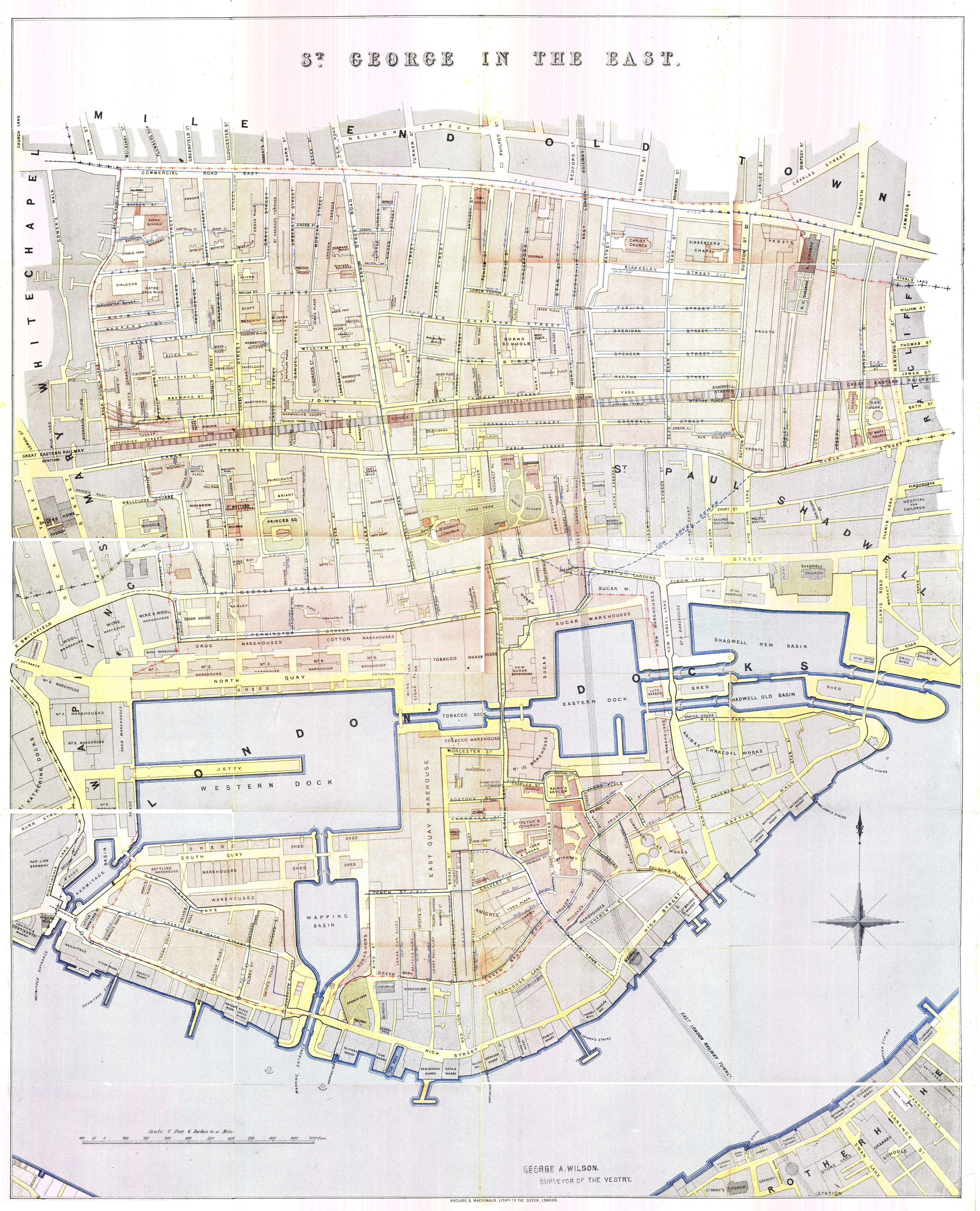
On this map Johnsons Back Change is not identified but can be assumed to be close to Blue Anchor Yard (see red line running parallel to Dock Street on this map (just to the north of Katherine Docks).
https://london1868.com/weller45b.htm
On this map Johnsons Back Change is not identified but can be assumed to be close to Blue Anchor Yard (see red line running parallel to Dock Street on this map (just to the north of Katherine Docks).
More information on the health conditions of these locations can be found in the reports.
The “Underground Map” 15 for 1860 locates Johnson's Backchange just to the north of the Royal Mint. See https://theundergroundmap.com/article.html?id=102407&zoom=15&annum=1860

Some more information about Whitechapel can be found here:
https://spitalfieldslife.com/2014/12/09/gustave-dores-east-end/

 Gustave Dore illustrations of 19th century London
Some more information about St Georges in the East can be found here:
Ragged London in 1861 Written by John Hollingshead and published in London by Smith, Elder & Co., 1861. has interesting comments extracts below (https://www.mernick.org.uk/thhol/raglon03.html)
“The latest parochial statistics in St. George's in the East (for the week ending January 19, 1861) show that the poor-law guardians relieved 3,720 out of an estimated population of 60,000, and issued some 600 summonses for the last quarter's rates.
The whole area of the parish is three quarters of a mile long, by three quarters of a mile broad.”